 Dover Run Club - NH Running Community
Every Tuesday we run one of these routes from The Brick. Tap "Copy link" on a route to share it, or right-click (or press and hold on mobile) its title to copy the link directly from your browser.
Common Routes
Mt. Vernon 3 Mile
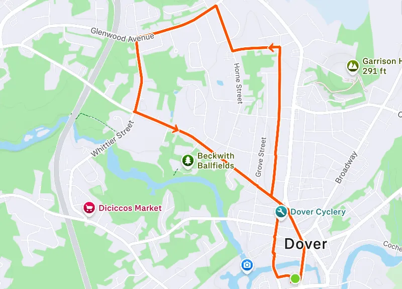
From Orchard: right on Chestnut, left on Sixth, right on Mt. Vernon, left on Roosevelt, right on Horne, left on Glenwood, left on Whittier, left on Sixth, right on Central, right on Orchard back to The Brick.
Mt. Vernon 4 Mile
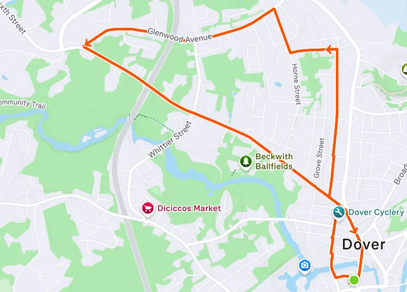
From Orchard: right on Chestnut, left on Sixth, right on Mt. Vernon, left on Roosevelt, right on Horne, left on Glenwood. Instead of turning on Whittier, stay straight on Glenwood to Sixth. Left on Sixth, right on Central, right on Orchard back to The Brick.
Mt. Vernon 5 Mile
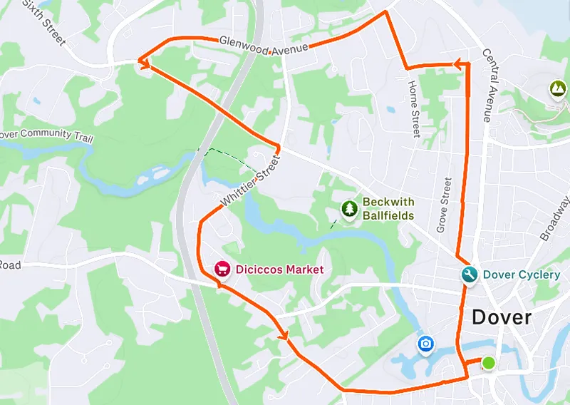
Start the same as the 4-mile route through Glenwood and Sixth. Instead of heading directly to Central, right on Whittier, left on Washington, left on Chestnut, right on Orchard back to The Brick. (Same as Washington Reversed)
Washington 3 Mile
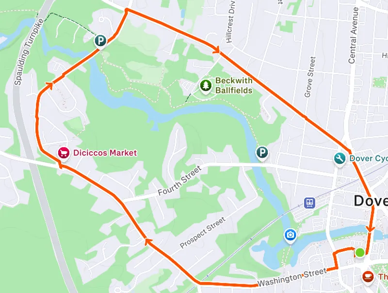
From Orchard Street, head up to turn left on Chestnut, then right on Washington and all the way out to a right on Whittier. Head up to the traffic light and then take a right onto 6th Street. Follow Sixth all the way back into town and then a right on to Central, which you take back to the starting point for just over 3.25 miles.
Washington 4 Mile
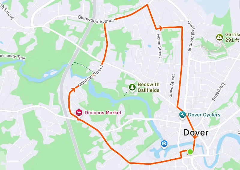
From Orchard Street, head up to turn left on Chestnut, then right on Washington and all the way out to a right on Whittier. Head up and cross over 6th Street at the light, and continue on to Glenwood Ave, where you take another right. Continue on Glenwood until taking a right on Horne Street, then a left on Roosevelt across from the school. After climbing Roosevelt, take a right on Mt. Vernon and follow that all the way back to Sixth, where you take a left and then a right on to Central, which you take back to the starting point for just under 4.5 miles.
Washington 5 Mile
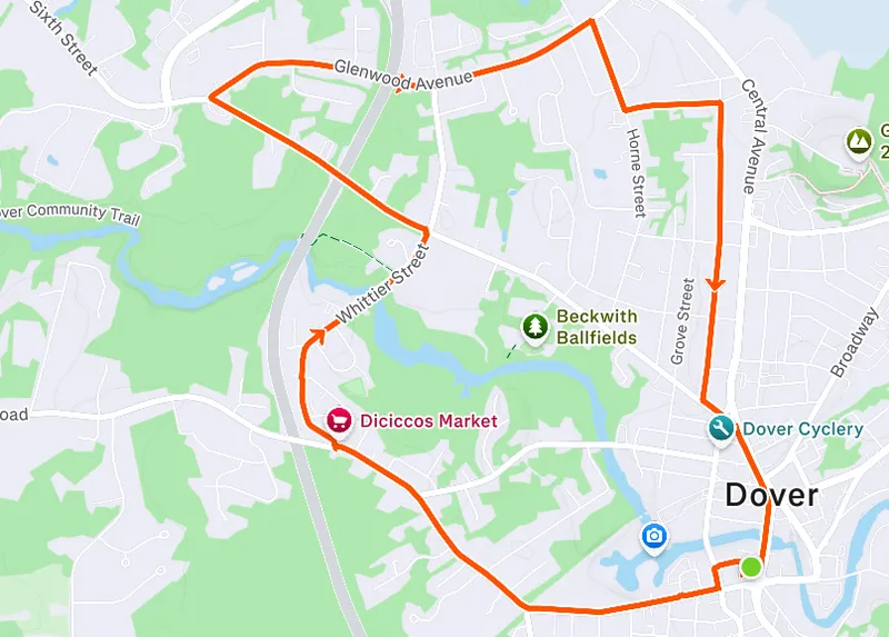
From Orchard Street, head up to turn left on Chestnut, then right on Washington and all the way out to a right on Whittier. Head up to take a left on Sixth Street at the light, and follow that until Glenwood Ave, where you take a right. Continue on Glenwood until taking a right on Horne Street, then a left on Roosevelt across from the school. After climbing Roosevelt, take a right on Mt. Vernon and follow that all the way back to Sixth, where you take a left and then a right on to Central, which you take back to the starting point for about 5 miles.
Red's 3 Mile
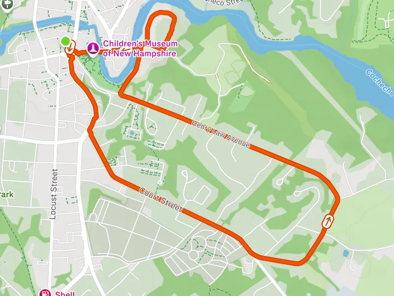
From Orchard: right on Central crossing the intersection, follow Central to Court. Left on Court and split left at the cemetery on to Back Rd. Follow Back Rd to Henry Law. At the bottom of Henry Law hill, take a right on to Payne St. and loop around Nebi Park, and finally run down Washington. Follow Washington back to the intersection with Central, taking a right on Central and back to Orchard and The Brick.
Red's 5 Mile
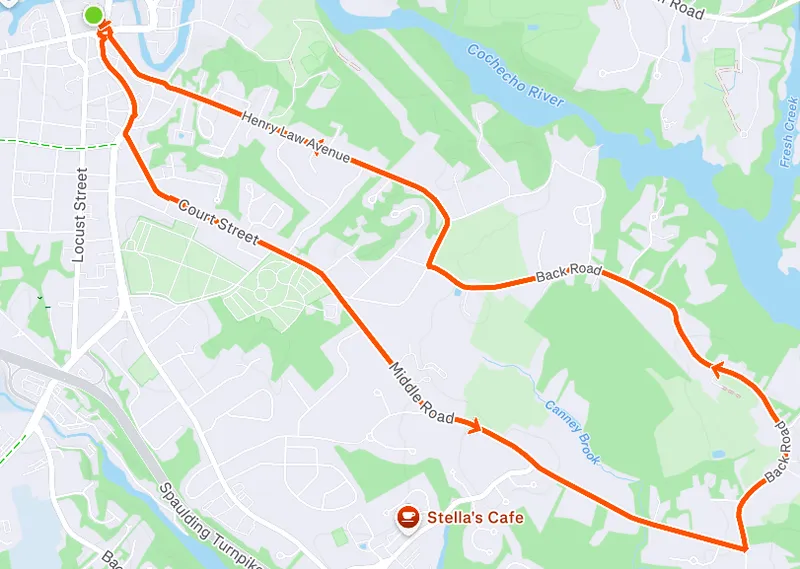
From Orchard: same as the 3-mile route but instead of splitting left at the cemetery, split right onto Middle Rd. Follow Middle Rd to the end and take a left onto Back Rd. Follow Back Rd to Henry Law, and follow Henry Law until it meets back at the intersection of Washington and Central. Cross the intersection following Central, and back to Orchard and The Brick.
DCT Community Trail 3 Mile
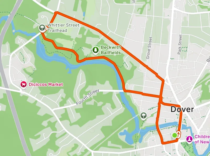
An easy three-mile route starting and ending at The Brick, and incorporating a stretch of the Dover Community Trail (Fourth St to Whittier St).
DCT Community Trail 5 Mile
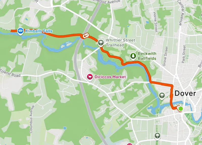
A five-mile route starting and ending at The Brick, and incorporating a longer stretch of the Dover Community Trail as an out-and-back (Fourth St to Liberty Mutual Campus).
Member Routes
Routes contributed by club members — same great Dover roads, new perspectives.
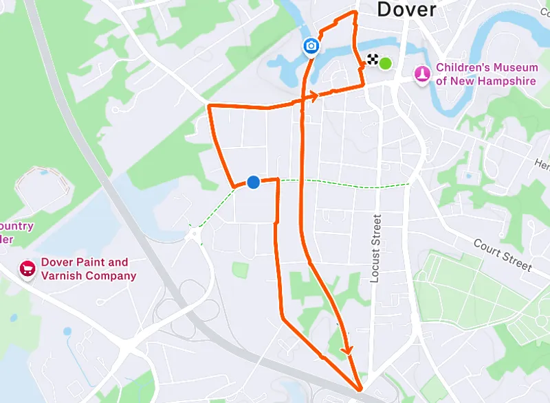
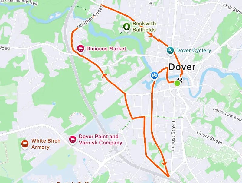
AF's Community Trail 3 Mile
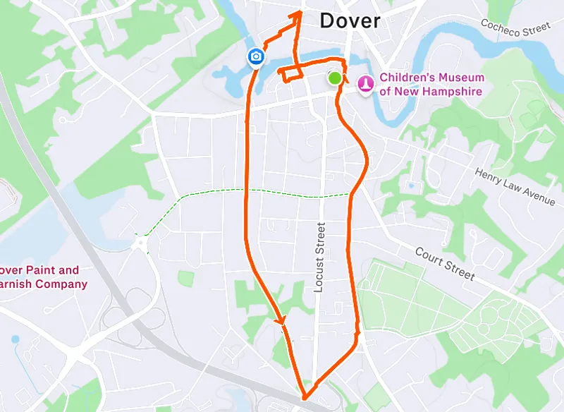
Contributed by AF
We take the community trail down and loop back on 108 to return to the Brick, or optionally take the community trail back.
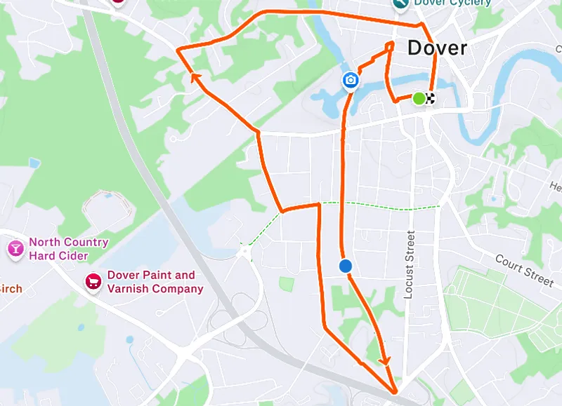
AF's Community Trail 5 Mile
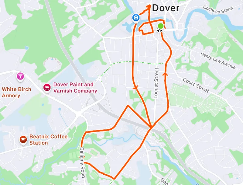
Contributed by AF
We take the community trail down and loop around the Dover High School, and follow 108 back to the Brick, or optionally take the community trail back.